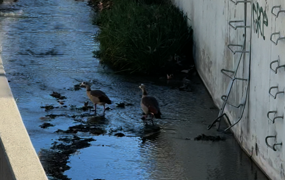
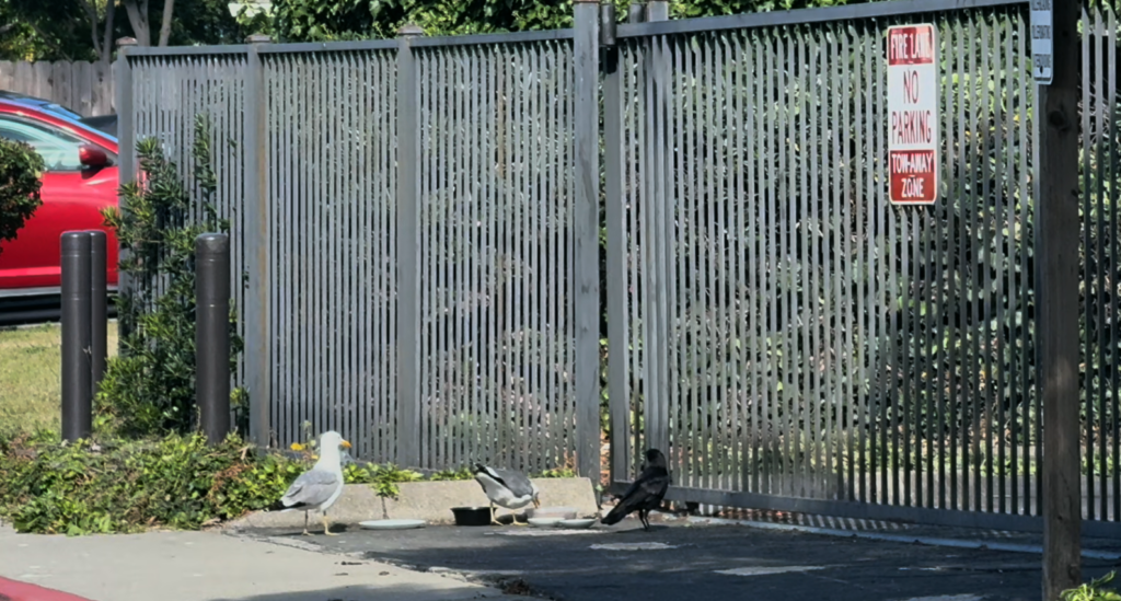
There was an unexpected wildlife gathering at a neighborhood fence recently.
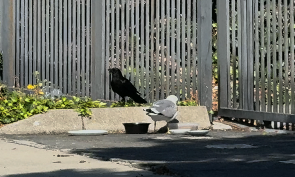
What appeared at first to be a simple bowl of food left out for stray cats quickly became something more complicated. A pair of seagulls had claimed the area, standing guard over the cat food while keeping other visitors at a distance. A crow waited nearby. Another crow joined. Somewhere inside the fenced area, a cat briefly appeared before disappearing again.
The scene became an interesting study in behavior, competition, and resource guarding.
Watching wildlife interact around a food source often reveals patterns that might otherwise go unnoticed. Different species respond to opportunities in different ways, but many behaviors appear surprisingly familiar. In this case, the seagulls were clearly attempting to control access to the food, repeatedly pushing away the crows and defending the resource.
Eventually, one crow managed to secure a piece of food. For a moment, the balance shifted. The seagulls backed off, and the crows had an opportunity to eat.
What stood out most was not simply the competition between species, but the differences within each species. There were two seagulls and two crows, and in both cases one individual appeared noticeably bolder than the other. One bird consistently approached first while the other remained more cautious.
Patterns like this appear throughout the natural world. Even among animals of the same species, responses to risk, opportunity, and competition can vary significantly.
The observation also prompted a broader question: what happens when people feed wildlife?
Many people have encountered wildlife that appears unusually comfortable around humans. On a recent hike, numerous juvenile rock squirrels approached visitors expecting food. Nearby conversations suggested some animals had been receiving snacks such as chips and other processed foods.
The situation may seem harmless or even amusing at first. Yet feeding wildlife often changes animal behavior in ways that are not immediately obvious.
Animals can begin associating people with food. Natural foraging behaviors may shift. Competition between species may increase. Animals that would not normally interact around a particular resource may suddenly find themselves competing for the same meal.
Even well-intentioned feeding efforts can produce unexpected outcomes.
A bowl of food intended for stray cats may become a feeding station for seagulls. Bird seed may attract raccoons, possums, and other visitors. Food placed for one species frequently becomes available to many others.
The result is often a complex system of interactions rather than a simple act of feeding.
Perhaps the most interesting part of the observation was how familiar some of the behaviors felt. Resource guarding is commonly discussed in domestic animals, particularly dogs. Yet similar patterns emerge across many species whenever resources become limited or concentrated in one location.
Competition, cooperation, caution, boldness, and opportunism are not unique to any one species. These behaviors appear repeatedly throughout natural systems.
Sometimes a small wildlife encounter becomes a reminder that ecosystems are connected in ways that are easy to overlook. A bowl of cat food can become a gathering place for cats, seagulls, crows, and countless behavioral interactions that unfold in real time.
Not every observation requires a conclusion.
Sometimes simply noticing the pattern is enough.
▶️ Watch here
Learn more about Watearth at our homepage.