What is FEMA?
FEMA stands for the Federal Emergency Management Agency and was established via Executive Orders 12127 and 12148 signed by then-President Jimmy Carter. Carter gave FEMA the “dual mission of emergency management and civil defense.”
Today, FEMA’s mission is defined as, “helping people before, during and after disasters, and our guiding principles help us achieve it.” FEMA supplies numerous services from disaster unemployment assistance to risk management information and grants.
Flood Maps
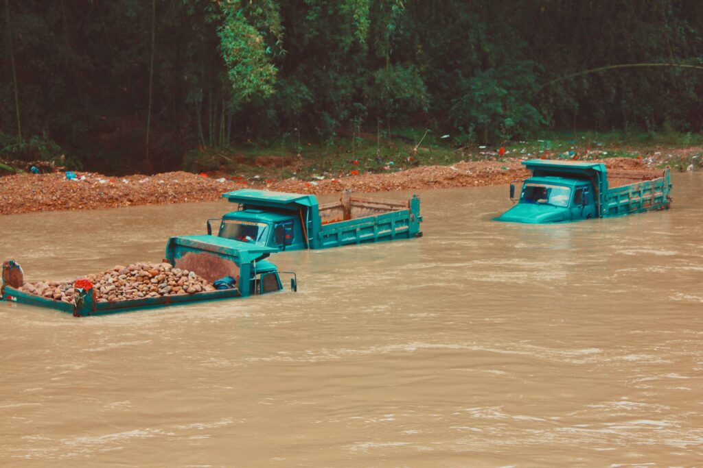
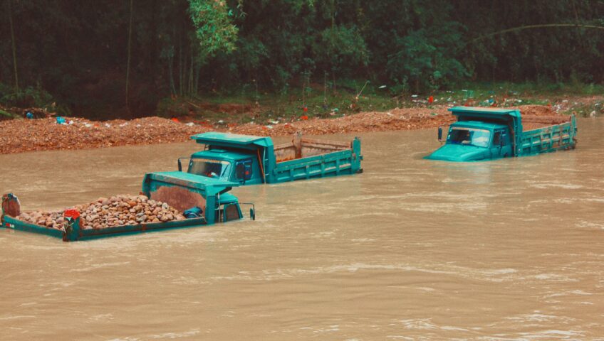
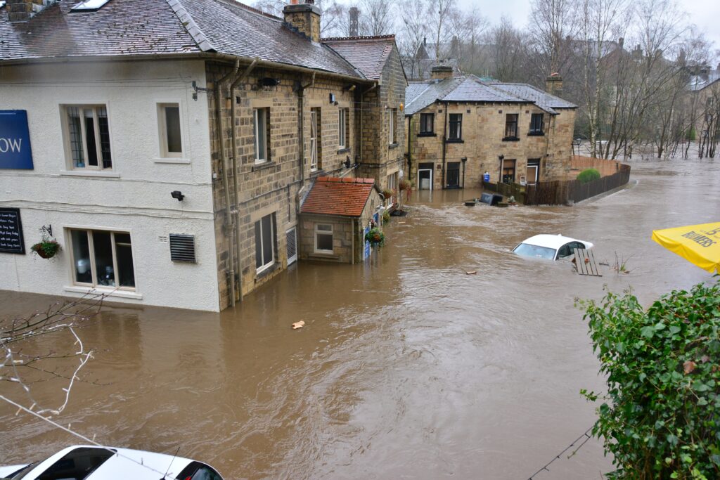
One key service FEMA provides is flood maps. Floods are meteorologically unpredictable and are increasingly a result of climate change. Most recently, areas of western Europe have been hit with massive flooding, completely washing away roads and homes. Germany and parts of Belgium were hit the hardest, with a confirmed death toll above 160 people. In the United States, Tennessee suffered a flash flood as a result of 17 inches of rain falling in a 24 hour period. At this point in time, the death toll lies at 20. 270 homes were destroyed and another 160 experienced significant damage.
These heavy and sudden rainfalls are attributed to climate change and are likely to become more common as average global temperatures rise annually. As the atmosphere warms, it holds and precipitates more water. Additionally, in areas that experience regular snowfall, the snow melts faster and earlier, leading to spring flooding. There has also been an increasing frequency of hurricanes and sea levels are rising, all factors contributing to an increase in flooding.
FEMA provides flood maps online via their FEMA Flood Map Service Center (MSC). These maps aim to help communities understand the flood risk in their areas, and can help guide decisions regarding reducing or managing flood risk.
Flood maps work by indicating the flood risk within a zip code area in the United States. These maps are very localized, and can even indicate where the level of an individual stream is likely to rise. FEMA designates any area that has a 1% chance or higher of experience a flood each year as a high-risk location. The 1% annual exceedance probability (AEP) is the basis of the National Flood Insurance Program. A 1% AEP flood has a 1 in 100 chance of being equaled or exceeded within a year, it has a recurrence interval of approximately 100 years – meaning it is a “100-year flood.”
FEMA also allows revisions to the flood maps. These include Conditional Letter of Map Revision (CLOMR), Letter of Map Revision (LOMR), and Letter of Map Amendment (LOMA). A CLOMR does not revise a National Flood Insurance Program (NFIP) map, it indicates whether a proposed project (i.e. modifying a floodway) would be recognized by FEMA. A LOMR is FEMA’s modification to an effective map. These are based on physical measures implemented in an area that would affect the hydrologic/hydraulic characteristics of a flood source. A LOMA is an official amendment to a NFIP map.
Watearth’s Work With Floods
Here at Watearth, we understand the importance of floodplain mapping and other preventative measures. We take on numerous projects to help with drainage master plans and flood plain management.
Our CEO, Jennifer J. Walker, P.E., D.WRE, CFM, ENV SP, QSD, worked with the City of Houston Regional Detention Stormwater Master Plan (Including Water Quality Analysis). This high-profile project, initiated by the Mayor, identified, analyzed, and selected regional detention sites to mitigate City Capital Improvements Plan (CIP) projects and reduce flooding. During the project, Watearth also performed watershed and impacts analysis in HEC-HMS, performed a cost-benefit analysis, and targeted TSS and bacteria for impaired watersheds. Additional project components included evaluating, analyzing, and recommending stormwater quality Best Management Practices (BMPs) for CIP roadway, LID, and drainage projects. Watearth also included recommendations for stormwater quality BMPs associated with regional detention facilities and drainage features within park land for educational purposes.
Additionally, Watearth collaborated with the City of Austin on their Stormwater Drainage Criteria Manual (DCM). Watearth worked on the forward-thinking drainage criteria manual that played a crucial role in protecting and restoring the health of the City’s watersheds and also protects the City’s investment in stream restoration and natural channel design projects. Updates to the DCM were incorporated into City code following City protocols and code update processes. Watearth performed a literature review and data evaluation related to methods used nationwide to address excess urban runoff volume and provided recommendations for stormwater control/management strategies to achieve volumetric detention goals for the City of Austin. The project recommendations complied with federal, state, and local regulations for stormwater quality. We developed Volumetric Design Procedure criteria and recommended incorporation of Green Infrastructure and Hydromodification Management techniques. Additionally, Watearth developed guidance and criteria for developing stage hydrographs and tailwater criteria for detention routing and performed peer review of natural channel design criteria revisions. Other project elements included performing HEC-HMS modeling (hydrology) and evaluating the effect of rainfall distribution on peak flows and estimated detention volumes for the 25-year and 100-year rainfall events using updated NOAA Atlas 14 rainfall depths.
Watearth also worked on three watershed studies and a prepared Letter of Map Revisions (LOMR) submittals to the Federal Emergency Management Agency (FEMA) to remove filled areas within the regulatory flood plain for three project sites; Cedar Brook Ridge, Creekside Hills, and Heartwood Park (TX). Also in Texas, Watearth has updated FEMA’s floodplain maps and these were integrated into FEMA’s digital geospatial flood inundation mapping tool, which aims to accurately reflect observed and modeled hydrodynamic conditions to improve communication, understanding, and public safety before flood events occur.
If you’d like to learn more about Watearth’s work with hydrology and hydraulics and the services we offer, please visit our website.